Land Use Tax Assessment in Virginia
 Land use is exactly what it sounds like…the management and modification of natural environments/wildernesses into “built environments” which house manmade structures like cities and neighborhoods used to serve human needs. Land use laws make it possible for a locality to assess real estate based on “use value” rather than “fair market” value. Land use laws have several purposes: guaranteeing an available source of forest products, conserving natural resources in ways that will prevent erosion, protecting sufficient safe-water supplies, preserving natural beauty and scenic open spaces, promoting proper land-use planning, and reducing pressure to convert places into more intensive land use. In short, land use assessments help landowners stave off pressure to develop land.
Title 58.1-3230 of the Code of Virginia states that, “a county, city, or town may adopt an an ordinance that provides for use-value assessment under four categories: real estate devoted to agricultural use, horticultural use, forest use and open space use. Land used in agricultural and forestal production in an agricultural district, a forestal district, or an agricultural/forestal district is eligible for use value assessment in the absence of a local ordinance.” The State Land Use Advisory Council (SLEAC) was created in 1973 to estimate the use value of qualifying land for every locality participating in a use-value program. As of now, 64 counties and 13 cities in Virginia including Albemarle County participate in a use-value program. There are some people, like Martha Moore of the Virginia Farm Bureau who see land use assessment as an effective (if temporary) method to halt excessive land development. Moore says, “Without land use assessment, the tax burden would increase so rapidly that the land would not be able to be used for agriculture or forestry operations. There would be development at a rapid pace rather than at a planned pace.”
Once a city, county, or locality adopts local land use ordinances, any parcel that meets state criteria for the category in question (agriculture, forestry, etc.) must be granted use value taxation. The County doesn’t have the right to impose any additional eligibility requirements. Before use-value assessment is granted, the local assessing officer must decide whether or not land meets the uniform standards set forth by either the Commissioner of Agriculture and Consumer Services, the State Forester, or the Department of Conservation and Recreation.
Are you someone who owns property in Virginia? Wondering if your property qualifies for land use valuation? You must submit an application to the county for taxation on the basis of use assessment at least sixty days prior to the tax year for which the reduced taxation is sought. You must also submit a reapplication whenever acreage or change in land use occurs. You may be asked for any of the following items:
- The assigned USDA/ASCS farm number
- Federal tax forms like: Farm Expenses and Income (1040 F), Farm Rental Income and Expenses (4835), or Cash Rent for Agricultural Land (1040 E)
- A conservation Farm Management and/or Forest Management plan prepared by a professional, or a letter of intent stating that the land will be forested
- Evidence that your farm’s gross sales averaged more than $1,000 annually over the past three years
Check out the classifications below to determine whether land use assessments apply to your land. Albemarle County adopted all four land use categories in 1975. From the Albemarle County page on land use, here are the qualifications that your land must meet if you plan to apply for land use valuation:
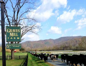
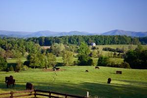
Agriculture/Horticulture Use: Land used for agricultural use must consist of a minimum of five acres and must meet prescribed standards for a bona fide production for sale of crops and/or livestock or be in an approved soil conservation program. Land used for horticulture use must consist of a minimum of five acres and must meet prescribed standards for bona fide production for sale of fruits, vegetables, ornamental plants and/or ornamental products. In either case, you must also be able to prove a five-year previous history of continuous farming. If land is left vacant, idle, or neglected for a year or more, farm history starts over for five years.
The land needs to be qualified on the basis of selling crops or livestock. It must make over $1,000 annually. The applicant must certify that the real estate is being used in a planned program of management, production and sale of field crops, livestock, poultry, dairy, fruits, vegetables, etc.
If qualifying under livestock classifications, the minimum stocking requirements are: 1 cow, 1 horse, 5 sheep, 5 swine, 100 chickens, and/or 66 turkeys for every five acres. Horses only qualify if they’re being used for breeding or boarding…recreational horses don’t count.
Forest Use: Land used for forestal use must be a minimum of twenty acres and must include standing timber and trees devoted to tree growth in such quantity and so spaced and maintained as to constitute a forest area. Must be exclusively devoted to forestal use, meaning no livestock access (otherwise, you must apply for the agricultural category). Required to have a forest management plan or a letter of intent stating that the land will be forested.
Open Space: Land in open space must be at least 20 acres or such greater minimum acreage, set by local ordinance, and be used to provide or preserve the land for park or recreational purposes, conservation of land or other natural resources, floodways, historic or scenic purposes or to assist in the shaping of the character, direction, or timing of community development, or for the public interest and consistent with the local land use plan. To qualify under open space use, real estate must be subject to a recorded perpetual conservation, historic, or open-space easement held by any public body.
If your Albemarle County land meets any of the aforementioned specifications for agricultural, horticultural, forestal, or open space land use, it would be highly beneficial to apply for land use valuation. Be sure to contact your county’s governing offices to obtain the latest and most accurate tax information for you land and farming operation. For any more questions about matters of land in central Virginia, contact Gayle Harvey Real Estate today!


 Land use is exactly what it sounds like…the management and modification of natural environments/wildernesses into “built environments” which house manmade structures like cities and neighborhoods used to serve human needs. Land use laws make it possible for a locality to assess real estate based on “use value” rather than “fair market” value. Land use laws have several purposes: guaranteeing an available source of forest products, conserving natural resources in ways that will prevent erosion, protecting sufficient safe-water supplies, preserving natural beauty and scenic open spaces, promoting proper land-use planning, and reducing pressure to convert places into more intensive land use. In short, land use assessments help landowners stave off pressure to develop land.